
🧠 This post is part of my brain gain series.
I’m sure a lot more was going on in 1507. But, according to Wikipedia which is where I get my brain gaining knowledge, not much happened in science that year. Currently, the main thing that is focused on is Cartography here on this 1507 in science page.
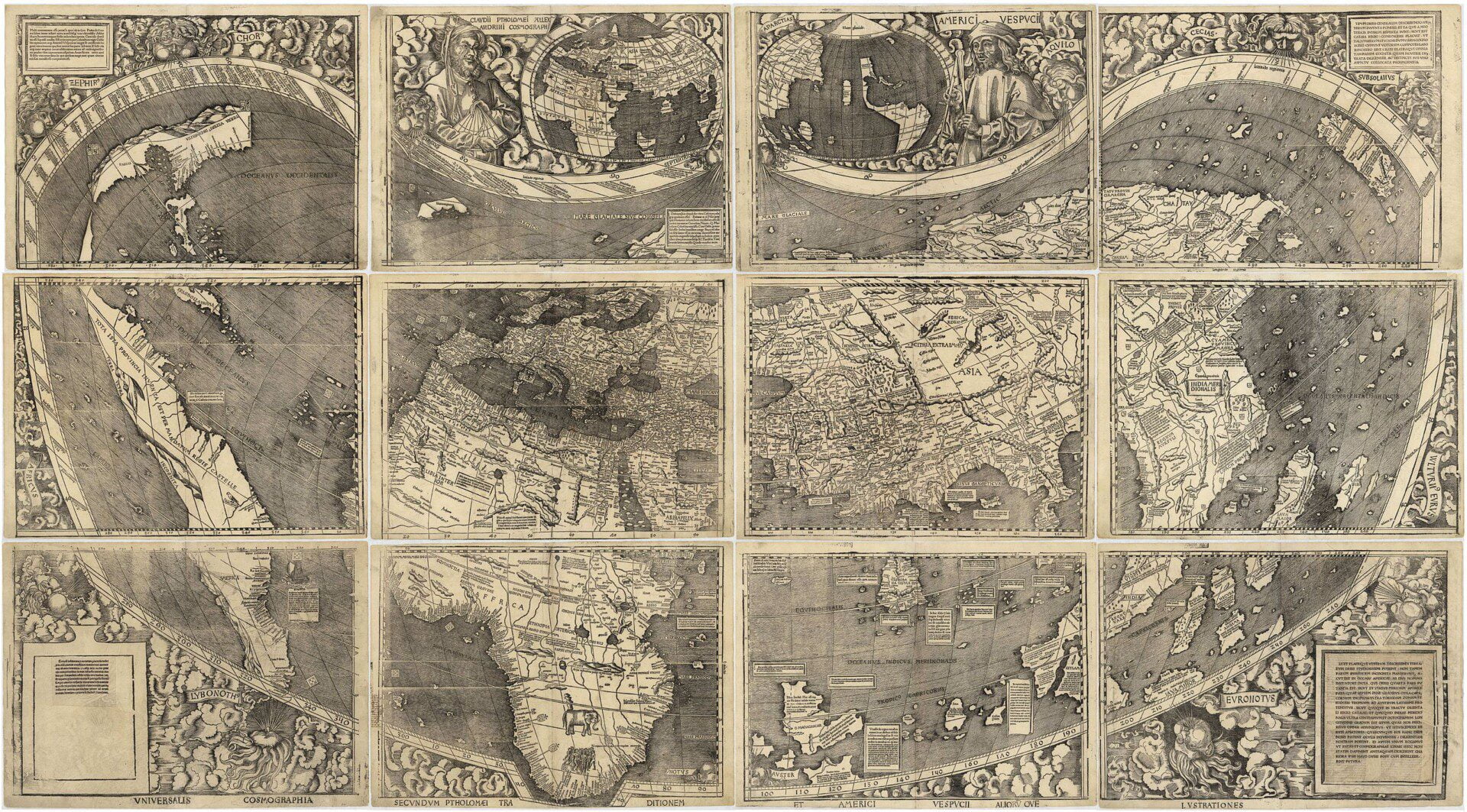
- April 25 – Martin Waldseemüller publishes Cosmographiae Introductio (“Introduction to Universal Cosmography“, probably written by Matthias Ringmann) and accompanying wall map, the first to show and name the Americas as a separate continent.
- Johannes Ruysch‘s map of the world is first published in editions of Ptolemy‘s Geography produced in Rome.
The first wall map to show the Americas as a separate continent is interesting. This is what they thought America looked like. They were working with what they knew. Airplanes didn’t come around until the 1900s and it took forever to sail from Europe to America. I’m impressed by how well Europe is mapped out to be honest. Sure, people had been in Europe for a long time at this point, but when all you have are wooden boats, this stuff is very impressive. Maps were art. Or, I guess one can say, maps ARE art.
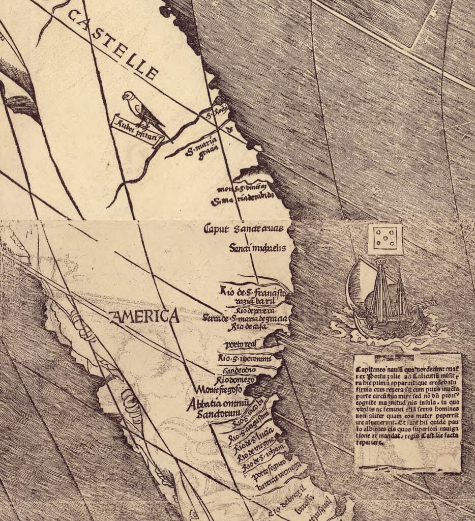
Close up of Universalis Cosmographia, the Waldseemüller wall map dated 1507, showing the word “America.”
Apparently, this map was lost for a long time. In 1901 it was found in Southern Germany by Joseph Fischer. Thanks, Mr. Fischer.
Leave a Reply